
Kintamani, Bangli · Central Bali
Mount Batur & Kintamani
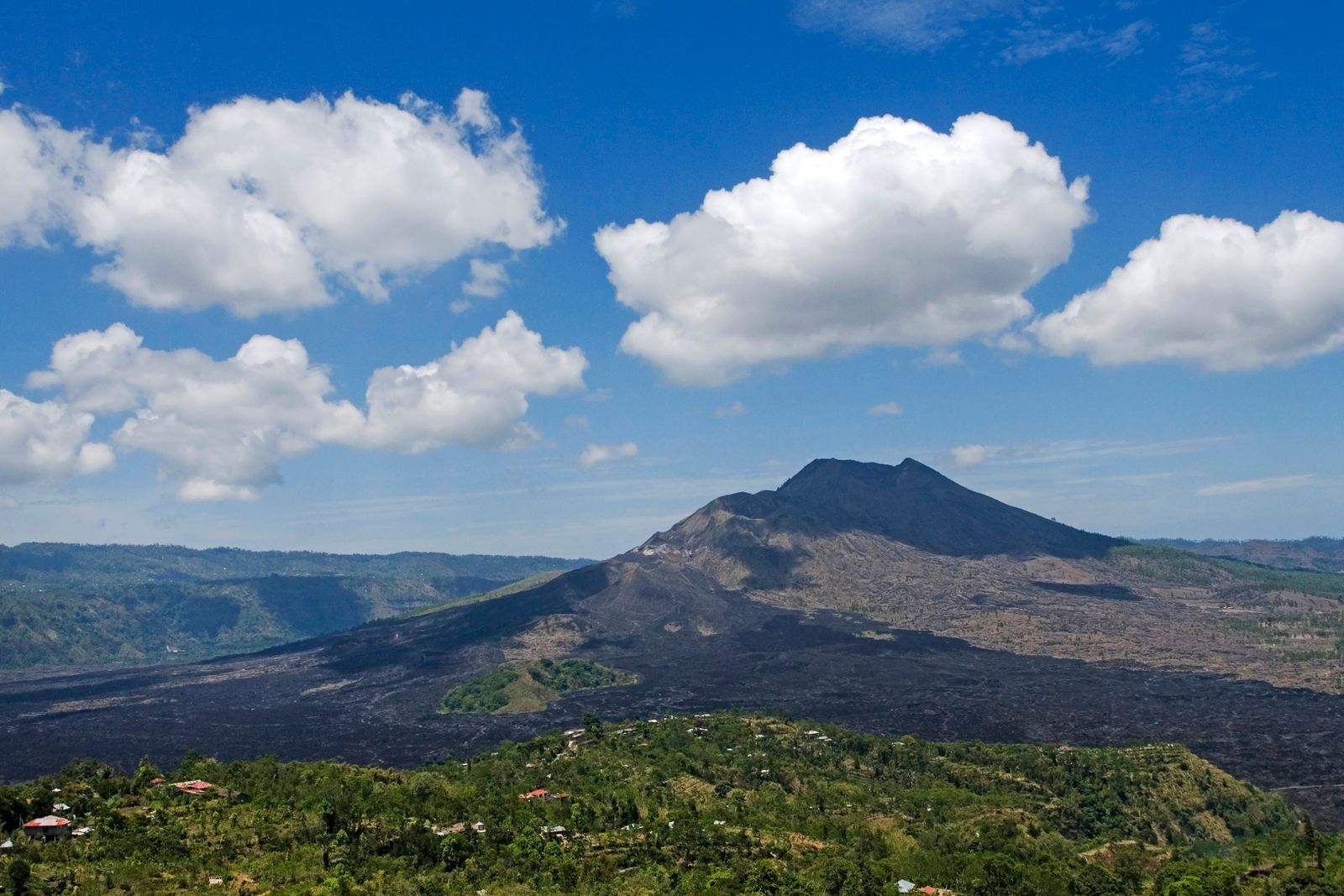
Mount Batur is an active volcano rising inside a vast caldera in the Kintamani highlands, and its pre-dawn climb is one of the most popular outings on the island.
Mount Batur is an active volcano rising inside a vast caldera in the Kintamani highlands, and its pre-dawn climb is one of the most popular outings on the island. Reach the top in time and the sun rises above the crater, the lake below and the old lava fields of the caldera floor.
History
Batur sits within a double caldera. The larger one, roughly 10 by 13 kilometres, formed when a magma chamber collapsed about 29,000 years ago, and a smaller inner caldera followed around 20,000 years ago. Inside it, a cone of about 700 metres now rises above Lake Batur, with the summit reaching 1,717 metres above sea level. It is among the best-known walks on the island.
Batur is still active. Its first documented eruption was in 1804, and the 1963 eruption left a broad field of black lava that is still visible from the Kintamani rim. The most recent eruption recorded on Wikipedia dates to 2000. In 2012 the caldera joined UNESCO’s Global Geoparks Network, a recognition of both its geology and of the villages that live within it.
Meaning and culture
The caldera is home to some fifteen villages, four of them main settlements, and most families still make a living from farming the fertile volcanic soil. Lake Batur adds fishing and irrigation, so the people around the volcano depend closely on the land and water that it shaped over thousands of years. Guides are local people who know the trail well, and most will happily explain how the mountain and the lake shape village life below.
That local stake shapes the trek today. Guides come from village trekking associations, and the permit and guide fees support the communities who live on the mountain. For that reason hiring a local guide is the expected way to climb, and in practice the trailhead will usually turn away anyone who arrives without one.
What to see
- Sunrise from the summit or the crater rim
- Steaming vents and warm ground near the top
- Lake Batur and the old lava fields from the Kintamani rim
- Toya Bungkah hot springs at the lake shore after the climb
Good to know
- Wear shoes with grip; the upper trail is loose volcanic scree
- Bring a warm layer and a torch or headlamp for the dark ascent
- Check the forecast, as cloud decides whether you see a sunrise
- Plan a rest day afterwards; the 2:00 am pickup is demanding
Quick facts
- Ticket Trek permit reported at about IDR 100,000 per person, plus a local guide (IDR 300,000-600,000 per group); shared tours bundle both. Fees vary by operator, so we confirm on booking
- Open Trail is open around the clock; treks usually start between 2:00 and 4:00 am
- Time needed 4-5 hours round trip, about 2 hours of climbing; allow a half day with breakfast
- Best time Dry season, April to October, for clearer skies; cloud can hide the sunrise in any month
- Distance about 1.5 to 2 hours from Ubud, 2 to 2.5 hours from south Bali (varies with traffic)
Location
Open in Google MapsFees checked October 2026 and may change.
More destinations
Keep exploring
Ready to explore Bali?
Tell us your dates and where you are staying. We will plan the day around you.